Map Activities: Township Maps
Township Maps

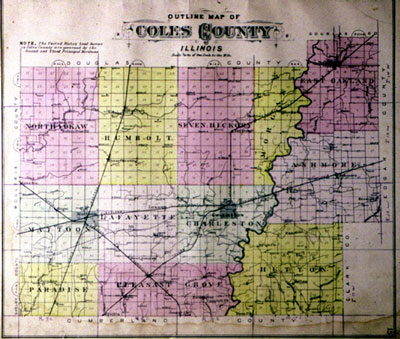
When land was surveyed during the nineteenth century, counties were divided up into townships. Each township was thirty-six square miles. Townships were subdivided into thirty-six sections, one square mile, or 640 acres, each. Sections might be further subdivided onto half sections, 320 acres, or quarter sections, 160 acres. This map shows the townships in Coles County. How many townships are there? Can you find the lines that divide the townships into sections?


